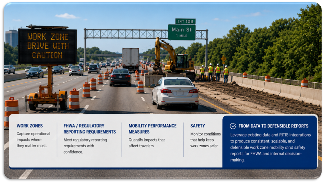
As the City of Charlotte works to close gaps in its bicycle network, the Charlotte Department of Transportation (CDOT) is using RITIS Temporal Comparison Maps to monitor the traffic impacts of a new downtown cycletrack project.
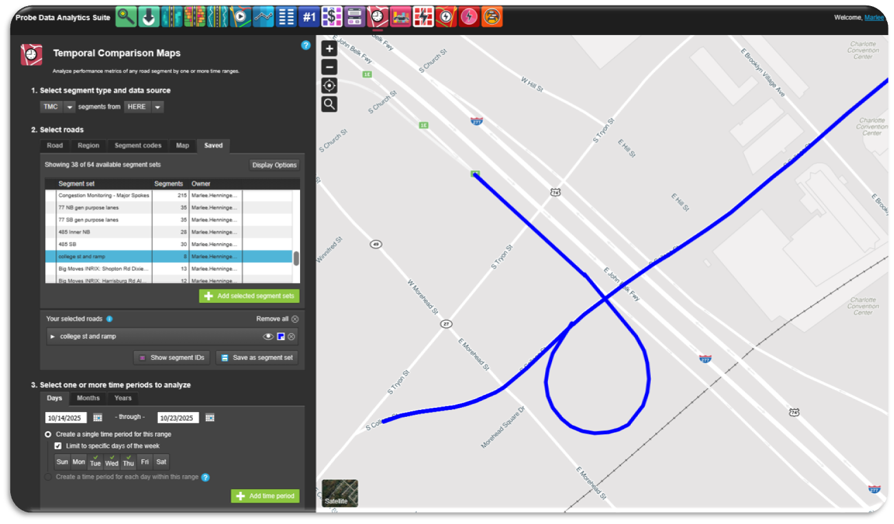
The project reallocated a curb lane on College Street in Uptown Charlotte to create a two-way cycletrack connecting a critical missing link in the city’s bike network. Because the corridor is near I-277 ramps, CDOT wanted a tool to compare pre-and post-implementation traffic, including queueing and travel time.
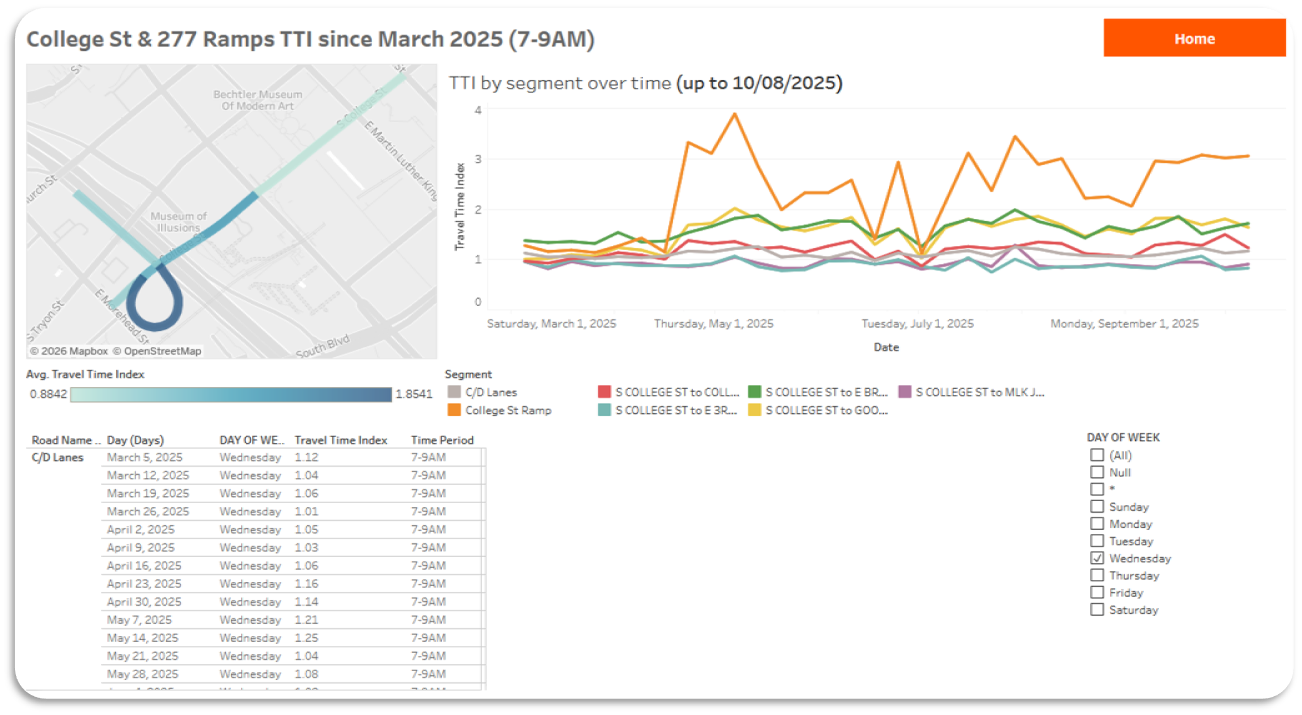
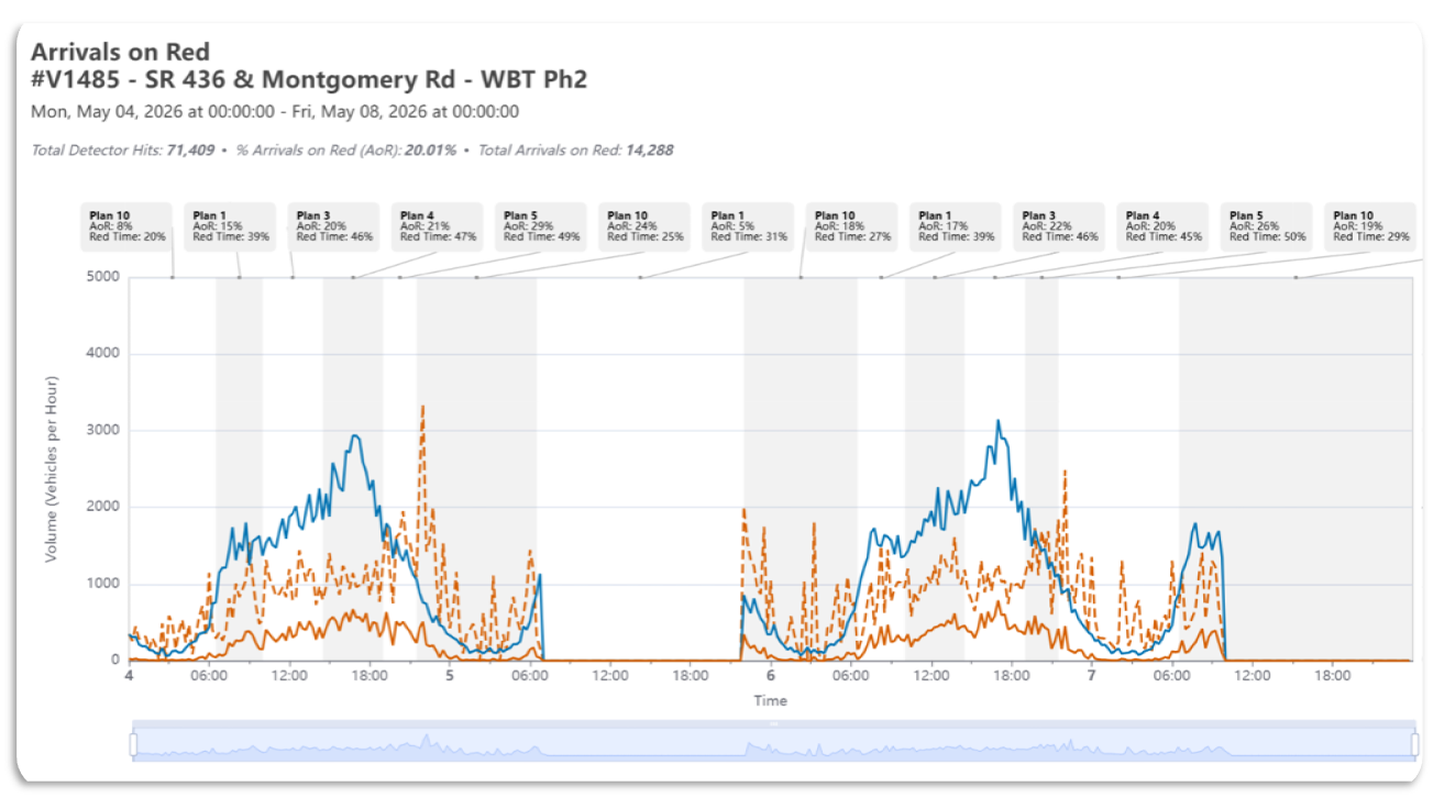
Using RITIS Temporal Comparison Maps, Marlee Henninge of CDOT created a saved segment set covering the project area, nearby ramps, and related interstate segments. She pulled Travel Time Index data daily and compared conditions by day of week and before/after implementation.
“We relied on RITIS Temporal Comparison Maps to track Travel Time Index trends over time, understand where impacts were occurring, and confirm that the effects were localized rather than spilling back onto the interstate.”
Her findings showed that the traffic impact was localized to the project area, and conditions stabilized after the initial implementation period.
To support ongoing monitoring, Henninge exported RITIS data into a master spreadsheet feeding a Tableau dashboard. This allowed CDOT project managers and department leadership to track trends, evaluate impacts, and communicate findings as the project progressed.
Henninge also began exploring automation through Microsoft Power Automate to streamline recurring RITIS queries. While still semi-manual, the workflow helps reduce repetitive setup steps and points toward future use of the RITIS API for larger or recurring analyses.
This use case shows how agencies can use RITIS Temporal Comparison Maps not only to evaluate project impacts, but also to support data-driven decision-making as safety-focused infrastructure investments are implemented.