


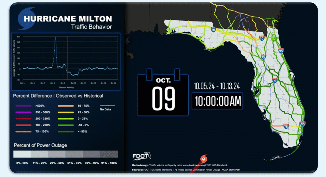
In an innovative approach to emergency management, CATT Lab recently harnessed the power of RITIS Trip Analytics to advance the understanding of vehicle evacuation routes during major wildfires. This innovative tool offers transportation professionals a robust method to analyze traffic patterns and enhance response strategies in the face of natural disasters.
RITIS Trip Analytics provides a detailed lens into congestion dynamics, comparing traffic conditions during a wildfire to typical days. The tool excels at identifying critical bottlenecks and shifting evacuation flows, offering real-time speed data that highlights areas of concern along key escape routes. Through the use of spatial filters and route maps, it paints a clear picture of how vehicles navigate through challenging terrains, adapting as the fire’s path evolves.
Looking ahead, CATT Lab plans to extend this analysis to inbound trips, post-fire recovery, and other fire events, aiming to inform critical policy decisions, public communication, and operational planning.
This application of RITIS Trip Analytics demonstrates its potential to transform emergency preparedness, providing actionable insights that could save lives and resources. For those interested in exploring explored further, please reach out to the CATT Lab for a demonstration. For further insight, view a video recording of a related webinar, accessible on YouTube here.