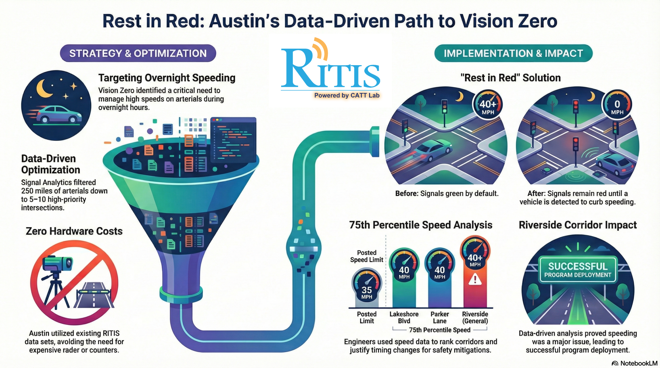
Speeding on city streets often requires expensive radar or physical counters to track, but the City of Austin found a smarter way. Using the RITIS Signal Analytics suite, the Austin Mobility Management Center (MMC) launched the “Rest in Red” program to improve overnight safety.
The program keeps traffic signals red on major corridors until a vehicle is detected, effectively forcing drivers to slow down and reducing the risk of high-speed crashes. By analyzing 250 miles of arterial roads using existing data, the team identified 8 to 10 high-priority intersections—such as the Riverside corridor—without spending a dime on new hardware.
As Allyson Richey, manager of the Austin MMC, explained during her recent presentation at the December 2025 RITIS User Group meeting:
“We’ve been expanding in recent years to use it in a much more atypical sense and kind of stretching our wings to see what are all of the ways we can really get that bang for our buck with this data set.”
By ensuring a sample size of at least 10 vehicles per study, the MMC provides statistically reliable results that can be used for ongoing “before and after” impact reports. It’s a powerful example of how creative data use can lead to safer streets and significant budget savings.