Imagine having eyes on every mile of your network—even the miles where your CCTV cameras don’t reach. For years, transportation agencies have relied on fixed ITS infrastructure to manage incidents. But as any operator knows, the most critical events often happen in the “dark zones”—those rural stretches, secondary arterials, or remote work zones where fiber hasn’t yet reached.
That is changing. With the latest Real-Time data integrations in RITIS, we are officially moving beyond the constraints of fixed hardware. By fusing Commercial Dash Cam Imagery and Real-Time Vehicle Movements, RITIS is turning the entire vehicle fleet into a distributed sensor network.
1. Virtual CCTV: Seeing Through the Driver’s Eyes
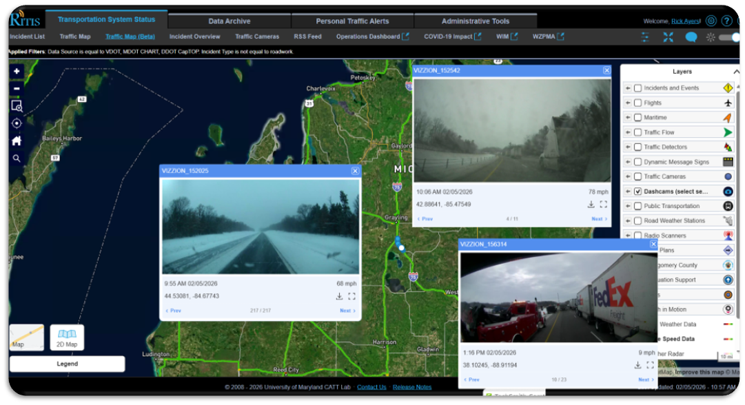
Why wait for a secondary report when you can see the scene for yourself? RITIS now integrates anonymized, real-time imagery from commercial fleet dash cams.
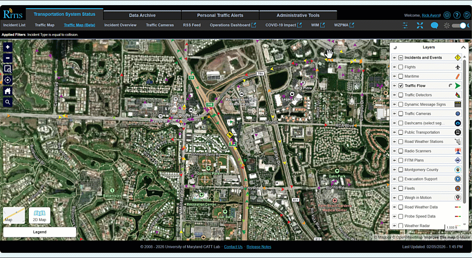
- Incident Confirmation: Withing RITIS Traffic Map (beta), instantly verify if a “stalled vehicle” report is actually a multi-lane crash, or check if a mobile DMS is properly deployed in a work zone—all without a single state-owned camera in sight.
- The Power of Context: For PDA Congestion Scans from the past week, dashcam snapshot locations appear as point symbols overlaid on the heat map. Simply click a symbol to open a window showing the road photo captured moments before the congestion.
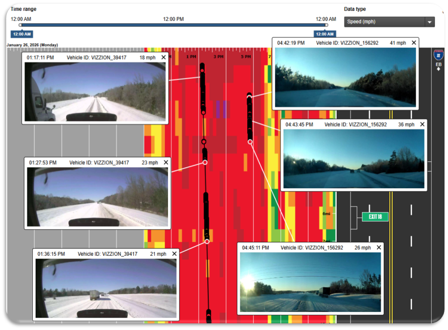
2. Live Trajectories: Tactical Intelligence for Major Surges
Speed data tells you how fast traffic is moving; the new Real-Time Vehicle Movements tell you exactly what they are doing. This isn’t just data on a chart; it is a live digital twin of your network during its most stressed moments.
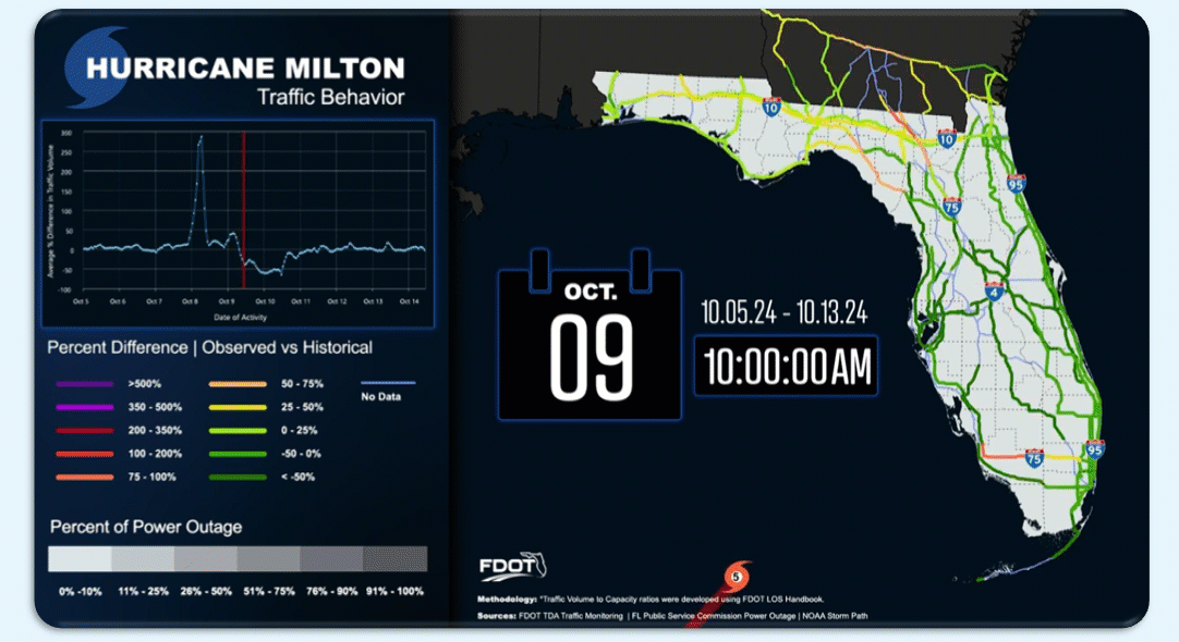
- Hurricane Preparedness & Evacuation: During events like Hurricane Milton, every minute counts. Operators can now watch live trajectories to pinpoint exactly where traffic is “leaking” off main corridors like I-75 and flooding secondary arterials that aren’t equipped for the volume.
- Global Events (FIFA World Cup): As the U.S. prepares for massive events like the upcoming FIFA World Cup, the challenge shifts to managing stadium surges. Live trajectories provide the “final mile” view, allowing TMCs to see how fans are navigating local streets and identify gridlock before it freezes the entire district.
- Detection & Detours: Watch vehicles navigate around bottlenecks in real-time, providing the ultimate operational “ground truth” to justify immediate signal timing changes or detour deployments.
Bridging the ITS Gap
These integrations are more than just “tech updates”—they are essential for Situational Awareness. By leveraging connected vehicle data, we are extending our operational reach to every corner of the state. Whether it’s a coastal evacuation or a global championship, RITIS ensures that if it’s happening on the road, it’s happening on your screen. If you are interested in evaluating these new data sources, please send an email to our director, Michae Pack, at PackML@umd.edu.